


Precinct 1, Petroleum County, Montana
About
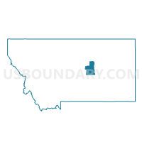
Outline

Summary
| Unique Area Identifier | 612202 |
| Name | Precinct 1 |
| County | Petroleum County |
| State | Montana |
| Area (square miles) | 1,673.80 |
| Land Area (square miles) | 1,654.87 |
| Water Area (square miles) | 18.93 |
| % of Land Area | 98.87 |
| % of Water Area | 1.13 |
| Latitude of the Internal Point | 47.14191680 |
| Longtitude of the Internal Point | -108.22657530 |
Maps


Graphs
Select a template below for downloading or customizing gragh for Precinct 1, Petroleum County, Montana


Neighbors
Neighoring Voting District (by Name) Neighboring Voting District on the Map
- Precinct 13, Garfield County, MT
- Precinct 19, Garfield County, MT
- Precinct 5, Musselshell County, MT
- Precinct 6, Musselshell County, MT
- Precinct 7, Musselshell County, MT
- Precinct 8, Musselshell County, MT
Top 10 Neighboring County Subdivision (by Population) Neighboring County Subdivision on the Map
- Roundup CCD, Musselshell County, MT (2,552)
- North Garfield CCD, Garfield County, MT (914)
- Grass Range CCD, Fergus County, MT (560)
- North of the Yellowstone CCD, Rosebud County, MT (546)
- Melstone CCD, Musselshell County, MT (412)
- Winnett South CCD, Petroleum County, MT (361)
- South Garfield CCD, Garfield County, MT (292)
- Roy CCD, Fergus County, MT (290)
- South Phillips CCD, Phillips County, MT (189)
- Winnett North CCD, Petroleum County, MT (133)
Top 10 Neighboring Place (by Population) Neighboring Place on the Map
Top 10 Neighboring Elementary School District (by Population) Neighboring Elementary School District on the Map
- Roundup Elementary School District, MT (4,109)
- Grass Range Elementary School District, MT (510)
- Melstone Elementary School District, MT (484)
- Sand Springs Elementary School District, MT (90)
- Ross Elementary School District, MT (25)
Top 10 Neighboring Secondary School District (by Population) Neighboring Secondary School District on the Map
- Roundup High School District, MT (4,246)
- Garfield County High School District, MT (1,206)
- Grass Range High School District, MT (594)
- Melstone High School District, MT (287)
Top 10 Neighboring Unified School District (by Population) Neighboring Unified School District on the Map
Top 10 Neighboring State Legislative District Lower Chamber (by Population) Neighboring State Legislative District Lower Chamber on the Map
- State House District 45, MT (9,438)
- State House District 32, MT (9,338)
- State House District 30, MT (9,083)
Top 10 Neighboring State Legislative District Upper Chamber (by Population) Neighboring State Legislative District Upper Chamber on the Map
- State Senate District 23, MT (23,380)
- State Senate District 16, MT (18,529)
- State Senate District 15, MT (17,708)
Top 10 Neighboring 111th Congressional District (by Population) Neighboring 111th Congressional District on the Map
Top 10 Neighboring Census Tract (by Population) Neighboring Census Tract on the Map
- Census Tract 301, Fergus County, MT (5,011)
- Census Tract 602, Phillips County, MT (4,253)
- Census Tract 1, Musselshell County, MT (2,539)
- Census Tract 1, Rosebud County, MT (2,520)
- Census Tract 1, Garfield County, MT (1,206)
- Census Tract 1, Petroleum County, MT (494)
Top 10 Neighboring 5-Digit ZIP Code Tabulation Area (by Population) Neighboring 5-Digit ZIP Code Tabulation Area on the Map
- 59072, MT (4,140)
- 59538, MT (3,037)
- 59087, MT (436)
- 59032, MT (408)
- 59054, MT (315)
- 59471, MT (295)
- 59318, MT (136)
- 59058, MT (50)